Page 1 of 1
Fire on the Mountain (time lapse) Grateful Dead
Posted: Sat Jul 23, 2016 8:25 pm
by dhmartens
[youtube]
http://www.youtube.com/watch?v=wyOqtUmR ... e=youtu.be[/youtube]
stills taken from LZ whack Cam.
soundtrack taken from here:
[youtube]
http://www.youtube.com/watch?v=JIXtLUVkAeI[/youtube]
Posted: Sun Jul 24, 2016 6:12 am
by dhmartens
Fox 11 Los Angeles posted raw aerial footage of Contractor Point area burning.
[youtube]
http://www.youtube.com/watch?v=W3HbvHui5Sw[/youtube]
Posted: Sun Jul 24, 2016 7:58 am
by dhmartens
http://abc7.com/news/tigers-chimps-othe ... e/1440477/
7/23/2016 4:33pm ABC AIR7HD shows video of the last mile of the road to launch is untouched in the video link above first 20 seconds.
The rest shows the Wild life station being evacuated of some 400 exotic animals.
Posted: Sun Jul 24, 2016 9:18 am
by JD
Here's a scene from 2008. When was the the fire that burned Big T? I have video from flying over that ghost land.
http://www.shga.com/forum/phpBB2/viewto ... 9d8e3d0d64

Posted: Sun Jul 24, 2016 10:55 am
by dhmartens
http://inciweb.nwcg.gov/incident/maps/4878/
Sand Incident pdf maps in high resolution.
low resolution

looks like the first two miles of the dirt road was overrun.
Posted: Mon Jul 25, 2016 7:44 pm
by dhmartens
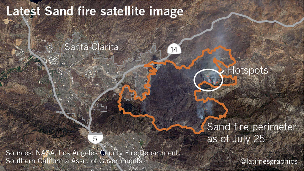
Latest Sand Fire Satellite Image from NASA July 25th (latimes)
Posted: Tue Jul 26, 2016 9:35 am
by dhmartens
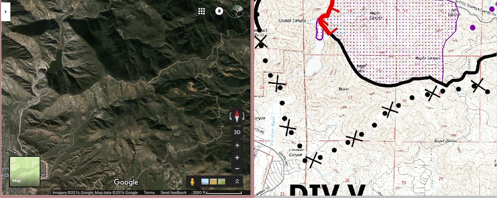
http://inciweb.nwcg.gov/photos/CAANF/20 ... 16-CDT.pdf
This map 7-26-2016 shows a proposed bulldozer line to be cut in front of the Pacoima Dam, in front of the Volcano and Bench and in front of Trash Mountain.
This could end up being a long bail out landing strip.
Posted: Tue Jul 26, 2016 6:59 pm
by dhmartens
California Declares State of Emergency
http://abcnews.go.com/US/firefighters-2 ... d=40887094
Bulldozer path looks to run right up the face of Trash Mountain to its peak.
Posted: Sun Jul 31, 2016 8:45 pm
by Greg Kendall
