
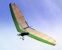
I'm answering a post by "Joseph" in the Subject, "Lukens and Big T Launches" here, because it is a different subject.
Synopsis - We are requesting the Forest Service to grade the road in a way that the Forest Service Regional Engineer proposed to redirect the surface water flow on the road away from the washout. We need a work party to do a hefty day's pick and shovel work. Read on.
Joseph –
For several years, we have been dealing with the ravine that threatens to undermine the road to launch. Now, before the first rains of the season, it is a good time to organize a work party to do what’s necessary to slow, if not prevent, further erosion. I’ll be happy to show you exactly what’s needed.
The Forest Service will grade the road to redirect surface flow off the side of the road above the ravine, and we will help by pick, shovel, and sandbag work to divert the flow off the hillside to the southwest of the saddle into the drain on the south side of the saddle.
The Ravine is in the Angeles National Forest. The Forest Service views erosion in the San Gabriel mountains as natural and inevitable. Their way of dealing with it is to cut off the water that is causing it. The Forest Service isn’t going to build a bridge over the ravine, and they aren’t going to fill it in. We certainly can't afford to do so, even if we could get permission.
A year ago, I met with Allen King, then the Forest Service Regional Engineer at the site of the ravine. (He has since retired.) He made recommendations to the District Ranger about how to deal with the erosion. A memo of our meeting is set forth below. It went to the District Ranger as well. The District Ranger has confirmed receipt of Allen's recommendations.
The two main recommendations were:
(1) to create a “rolling dip� in the road uphill from the saddle, to direct the flow off to the north side of the road in an area where there is underbrush and ground cover that will reduce erosion. A "rolling dip" is a berm that crosses the road diagonally, directing surface water on the road off to the side, usually into a "Bic Mac" a drainage structure made of corrugated metal that carries the flow away from the road. There is a "rolling dip" uphill from the area of the washout, just above the curve at the top of the hill.
(2) divert the flow that comes down the hillside south of the saddle into the drain chute (called a Big Mac) on the south side of the saddle.
Last fall, an SHGA work party did pick and shovel and sandbag work towards those objectives, but over time, traffic has erased our efforts. It’s time to renew that work.
Meanwhile, I am asking the District Ranger for the next road grading job to include a rolling dip, to be carved into the road uphill from the ravine.
MEMO OF SEPTEMBER 2005 re Erosion of Kagel Road
Allen King’s Inspection of Kagel Road Washout.
Tuesday, September 27, 2005 Allen King, Southern California Province Geologist, met me at the LZ and I drove him up to the washout near the top of Kagel Road. He looked it over carefully and said that the way to fix it is to direct surface runoff away from the galvanized metal culvert (they call them “Big Macs�) at the north side of the curve that feeds into the new canyon. It appears that we can do most of the work ourselves, except for one feature he wants uphill from the canyon. That is a “rolling dip,� a diagonal hump in the road that stops water from running down the road and directs the flow off to the side, preferably into a Big Mac. . A rolling dip requires earthmoving equipment, although we can construct a smaller hump (or humps) with sandbags that can help a lot. Allen made a drawing and said that he would send District Ranger Marty Dumpis a report on his findings and recommendations. Allen can’t control the action Marty will take or not take, but we can say to Marty that we can do 80% of the work by hand in the hopes that he can find the resources to construct the new rolling dip.
There was no discussion of the Forest Service attempting to fill the new canyon with rock or anything like that. I get the impression that the Forest Service considers erosion to be natural and inevitable, and that the best they can do is direct the flow of water away from a path that will eventually undermine the road.
On the way up, Allen and I stopped in to the District office. Allen said that he thought it would be the politic thing to do, since he was coming into Marty’s district. Howard Okamoto and Steve Bear came out and visited with us for a few minutes. We invited them to come with us, but they declined. Howard gave us a couple of topo maps. When I pointed out where I think the washout is, at the curve in the road on a saddle between two hills (on USFS property), Howard pointed to a point about 100 yards west on the topo ( on private property), saying that he thinks the washout is there.
At the washout site, I said to Allen “Now that we’re up here, I’d like to check where we are on the topo.� I again pointed to the spot I had indicated to Howard, and Allen agreed that we were where I believed the washout to be, definitely on Forest Service Land. So that issue is resolved. I took my GPS vario and let him copy the latitude and longitude from it.
The work needed to divert the water flow will be.
1. Build up the berm (ridge of earth) blocking the Big Mac that is now feeding the washout. Located at (1) on the attached drawing. North is at the bottom, according to the time-honored Chumash map drawing convention, where south was alwas considered the prime direction, as in “this project is going south,� or “on their date he went down to Tuna Town,� understood to be in a southward direction.
2. Unblock the Big Mac (2) on the south side of the road, where the VW rests in peace. He recommends cutting off the part of the door frame that sticks up above the level of the flow, so that it won’t trap debris that could block the Big Mac.
3. Build up a berm on the south side of the road between the 4 WD track that comes down the hill to the southwest. This is to direct that flow off the south side of the road into Big Mac No. (2).
4. Watch the flow of water on some rainy day to be sure that the rolling dip in the road east of the canyon, at (A), is diverting all the flow off that hill into Big Mac (3). Remedy as needed with sandbags. Patch the bullet holes in Big Mac (3) with roofing materials to prevent that leakage from eventually undermining Big Mac (3).
5. Clean out the top of Big Mac (4) up hill and slightly around the curve on the northwest side of Kagel Road. The grading has blocked it with a little sand berm.
6. Most important. Construct a rolling dip at B, to divert the flow in Kagel Road off the north side of the road before it gets down to the washout. Ideally a new Big Mac (5) would be installed there. Until we get the Forest Service to do this work. we should try to divert the flow of surface water off the road to the north in a couple of places with a berm of sandbags and rocks. That area is well vegetated and will absorb a lot of water before it starts a new canyon.
We will let Marty know what remedial action Allen King recommends for this washout, and tell him that we can to all the above, except constructing a proper rolling dip at point B, and installing a Big Mac (5). However, Rome says that he may have seen the remains of a Big Mac in the Wash, downstream from the LZ, and we may be able to salvage some of it, or construct one out of galvanized roofing. Or, they may authorize us to remove Big Mac (1), but I doubt it. Allen said that they might construct a flume to send any flow through Big Mac (1) farther downslope, so that the flow will hit the ground far away from the road. In any case, I think we should build the best rolling dip (or dips) that we can in that uphill section of the road before the next rains.
The Ravine Threatening to Wash Out Kagel Road
Moderator: Chip
The Ravine Threatening to Wash Out Kagel Road
Soar With Prudent Passion
Larry Chamblee
Larry Chamblee
Ravine, continued
resources to construct the new rolling dip.
There was no discussion of the Forest Service attempting to fill the new canyon with rock or anything like that. I get the impression that the Forest Service considers erosion to be natural and inevitable, and that the best they can do is direct the flow of water away from a path that will eventually undermine the road.
On the way up, Allen and I stopped in to the District office. Allen said that he thought it would be the politic thing to do, since he was coming into Marty’s district. Howard Okamoto and Steve Bear came out and visited with us for a few minutes. We invited them to come with us, but they declined. Howard gave us a couple of topo maps. When I pointed out where I think the washout is, at the curve in the road on a saddle between two hills (on USFS property), Howard pointed to a point about 100 yards west on the topo ( on private property), saying that he thinks the washout is there.
At the washout site, I said to Allen “Now that we’re up here, I’d like to check where we are on the topo.� I again pointed to the spot I had indicated to Howard, and Allen agreed that we were where I believed the washout to be, definitely on Forest Service Land. So that issue is resolved. I took my GPS vario and let him copy the latitude and longitude from it.
The work needed to divert the water flow will be.
1. Build up the berm (ridge of earth) blocking the Big Mac that is now feeding the washout. Located at (1) on the attached drawing. North is at the bottom, according to the time-honored Chumash map drawing convention, where south was alwas considered the prime direction, as in “this project is going south,� or “on their date he went down to Tuna Town,� understood to be in a southward direction.
2. Unblock the Big Mac (2) on the south side of the road, where the VW rests in peace. He recommends cutting off the part of the door frame that sticks up above the level of the flow, so that it won’t trap debris that could block the Big Mac.
3. Build up a berm on the south side of the road between the 4 WD track that comes down the hill to the southwest. This is to direct that flow off the south side of the road into Big Mac No. (2).
4. Watch the flow of water on some rainy day to be sure that the rolling dip in the road east of the canyon, at (A), is diverting all the flow off that hill into Big Mac (3). Remedy as needed with sandbags. Patch the bullet holes in Big Mac (3) with roofing materials to prevent that leakage from eventually undermining Big Mac (3).
5. Clean out the top of Big Mac (4) up hill and slightly around the curve on the northwest side of Kagel Road. The grading has blocked it with a little sand berm.
6. Most important. Construct a rolling dip at B, to divert the flow in Kagel Road off the north side of the road before it gets down to the washout. Ideally a new Big Mac (5) would be installed there. Until we get the Forest Service to do this work. we should try to divert the flow of surface water off the road to the north in a couple of places with a berm of sandbags and rocks. That area is well vegetated and will absorb a lot of water before it starts a new canyon.
We will let Marty know what remedial action Allen King recommends for this washout, and tell him that we can to all the above, except constructing a proper rolling dip at point B, and installing a Big Mac (5). However, Rome says that he may have seen the remains of a Big Mac in the Wash, downstream from the LZ, and we may be able to salvage some of it, or construct one out of galvanized roofing. Or, they may authorize us to remove Big Mac (1), but I doubt it. Allen said that they might construct a flume to send any flow through Big Mac (1) farther downslope, so that the flow will hit the ground far away from the road. In any case, I think we should build the best rolling dip (or dips) that we can in that uphill section of the road before the next rains.
Soar With Prudent Passion
Larry Chamblee
Larry Chamblee
Count me in
Christian thanks for the help. As we find out what the man power needed to get some real headway on the problem is we should get together, pick a date and get going. Thanks Larry for the info and help as always.
I will contact the Forest Service to request that they grade the road again.
Meanwhile, without touching the road, we need to organize a work party to rebuild the earthworks on the south side of the road to direct all the flow from the hillside into the Big Mac (corrugated metal drain) on the south side of the saddle.
This will take a big wad of people power, because it involves digging substantial trenches and building up berms high enough to handle the increasing flow that comes from that bare hillside, where the motorcycles have eradicated all the ground cover.
Maybe we should erect a barrier to prevent off-road vehicles from going up there. This could consist of railroad ties, or a telephone pole, or some other hard-to-move objects. I'll check with the Forest Service for permission to do that.
If we can't get any commitment for regrading the road, we should install a couple of smaller, hand-made lateral rolling dips up the hill. That will also be a fairly substantial project.
Christian or Joseph - - Pick a date for the work party - Saturday or Sunday mornings usually work best, gather the picks, shovels, wheelbarrows, sandbags, and other resources, let us know what you propose, and we'll put it on the website and in an email blast.
One more thought. IN case we have to do some road work. Our hand-made rolling dips didn't last very long last year. We need something that is more resistant to traffic and vandalism, like maybe some concrete curb sections, like they use in parking lots for stopping the cars' wheels. We could pin them into the ground with steel stakes (I have some I'd donate) and pile up rocks and earth on both sides of them.
Soar With Prudent Passion
Larry Chamblee
Larry Chamblee
-
Ken Andrews

- Site Admin
- Posts: 215
- Joined: Mon Jun 06, 2005 8:22 pm
- Location: Pasadena

-
SHGA Communications
- Posts: 106
- Joined: Sat Jul 15, 2006 11:20 am
- Location: Hang Gliding Capital of the World
Key to Map Above:
1. Build up the berm (ridge of earth) blocking the Big Mac that is now feeding the washout. Located at (1) on the attached drawing. North is at the bottom, according to the time-honored Chumash map drawing convention, where south was alwas considered the prime direction, as in “this project is going south,� or “on their date he went down to Tuna Town,� understood to be in a southward direction.
2. Unblock the Big Mac (2) on the south side of the road, where the VW rests in peace. He recommends cutting off the part of the door frame that sticks up above the level of the flow, so that it won’t trap debris that could block the Big Mac.
3. Build up a berm on the south side of the road between the 4 WD track that comes down the hill to the southwest. This is to direct that flow off the south side of the road into Big Mac No. (2).
4. Watch the flow of water on some rainy day to be sure that the rolling dip in the road east of the canyon, at (A), is diverting all the flow off that hill into Big Mac (3). Remedy as needed with sandbags. Patch the bullet holes in Big Mac (3) with roofing materials to prevent that leakage from eventually undermining Big Mac (3).
5. Clean out the top of Big Mac (4) up hill and slightly around the curve on the northwest side of Kagel Road. The grading has blocked it with a little sand berm.
Most important. Construct a rolling dip at B, to divert the flow in Kagel Road off the north side of the road before it gets down to the washout. Ideally a new Big Mac (5) would be installed there. Until we get the Forest Service to do this work. we should try to divert the flow of surface water off the road to the north in a couple of places with a berm of sandbags and rocks. That area is well vegetated and will absorb a lot of water before it starts a new canyon.
The two documents Joseph has put up are from last year. Most of the work described on that sheet needs to be redone after a year of use and abuse.
However, I did cut off the piece of the buried Volkswagen that was blocking big Mac #2, so unless it has regenerated, like a lizard's tail, we won't have to do that again.
The Forest Service has told me that they don't know when they can grade the road, maybe as late as the first of next year. That means we will have to renew the little rolling dips we put in the road last year.
They didn't last very long, and I think some well-intentioned Forest users wrecked them because they thought (contrary to view of the Forest Service's geologist) that water shouldn't be directed off the north side of the road. I think we'll need a way to make our new, handmade rolling dips more substantial and durable. What about burying something under the hump (I'm thinking of those pieces of concrete wheel stops that they install at the end of parking spaces), to make it last longer. Pin them into the ground with long rods of rebar.
Any ideas, civil engineers?
Soar With Prudent Passion
Larry Chamblee
Larry Chamblee
I'm not an engineer, but I wonder if it would be more effective to think of the rolling dip as creating a dip in the road, rather than building up the road to a hump.
Not a trench, which would be hard on vehicles and fill in quickly, but a wider, shallower channel intended the divert rain water where we want it to go. In this case I imagine that erosion would work in our benefit.
No doubt the rocky ground is difficult to work. Home depot rents an electric jackhammer which I've used and which works well in amateur hands. If there's interest, I'll check to see if they also rent a generator to power it.

Durable Drainage Design
The design of runoff diversions should be based on two things: (1) keeping the water flowing slowly and (2) minimizing the volume. The first prevents errosion and the second means a big diversion structure isn't needed.
Digging a diversion structure that has slow moving drainage is done by making it the proper grade, or steepness. Too steep, and the water will flow quickly carrying away sediment causing errosion. Too shallow and it will allow pooling and sediment will build-up until the diversion disappears.
The second key is to create enough diversion structures so that the volume of storm runoff in the worst storm can be handled without overflow. If the Kagel road section can handle it, put in two or more small diversions. This way the diversions/rolling dips can be made with light digging tools and don't need reinforcement with concrete and rebar.
The tough part is to determine the proper grade and volume for the road soils on Mt. Kagel. Although I don't have a clue, my guess is the Angeles Forest USFS has written guides for this.