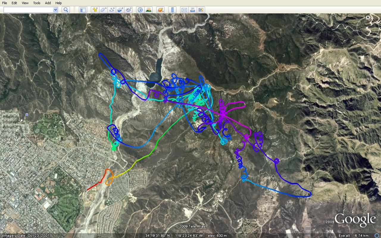
I downloaded this from my new old Garmen 76s and loaded in into google earth and did a screen capture. Its about 90 minutes, 33.24 miles. Max altitude was over 5300 feet and maximum ground speed was about 55mph on a Falcon 2 225.
dhmartens wrote:I downloaded this from my new old Garmen 76s and loaded in into google earth and did a screen capture. Its about 90 minutes, 33.24 miles. Max altitude was over 5300 feet and maximum ground speed was about 55mph on a Falcon 2 225.
Doug
Looks like you got around & around & around ,good going congratulations on your first track log.you'll have to show me how you did it some time.