Out-and-Return record broken

A place to stretch the truth a little...
User avatar
stebbins
Posts: 649
Joined: Thu Feb 24, 2005 9:02 am
Location: Palmdale, CA

Out-and-Return record broken

Post by stebbins »

Date: Thurday, July 5, 2007

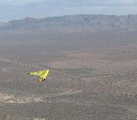
Task Distance: 207.6 miles
Official Distance: 206.6 miles :o (207.6 miles - 4 x 0.25 miles)

Air time: 7:54
Task time: 6:55

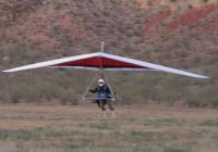
Launch at: 10:25 am at Walts Point
Task start: 11:10 am SE of Walts Point over the edge of the Owens Lake
Turnpoint : 2:24 pm West of Janies and North of Boundary Peak
Task done: 6:05 pm Same location as start
Landed at : 6:19 a bit north of the start point. (The LZ was better there.)

Start and turnpoints are all FAI 400 meter (0.249 mile) circles.

I will file the official papers soon. We'll see if I get the record. Sometimes things happen. Just ask Mike Barber. :wink:

Thank you Jim Mercadante for driving for me. And thanks for being under me with wind and LZ reports when I was landing after almost eight hours in the air... I just flew 200 miles, and boy are my arms tired. :wink:
Fly High; Fly Far; Fly Safe -- George
Steve Clark
Posts: 37
Joined: Sat Aug 19, 2006 2:17 am

Post by Steve Clark »

Congratulations George I hope you get it! :D
mercturns
Posts: 0
Joined: Fri Sep 29, 2006 8:33 am

Post by mercturns »

Yes ladies and gents its true....our very own George Stebbins kicked major backside on thursday, and after all was said and done a new unofficial world record had been set. George will no doubt give you all of the boring details later. For now though, I want to go on the record by saying congrats to George.....job well done....we're proud of ya! It was truly an epic flight in ballistic conditions, but by no means a for sure thing. In fact during his retun leg I had a visual on him as he was struggling big time at Black. Buy now George was sounding beat and conditions were starting to turn nasty....taking their toll on a guy who wasn't feeling that great prior to launch. You gotta hand it to him...he hung in there even after nearly being tumbled at Black.....yup its true saw it with my own two eyes. At that moment I stopped wishing I was up there with him and happy to be on the ground.....poor guy. 50 miles and two hours later George was back on the ground in pretty bad shape and no doubt happy it was over. Good job buddy!
User avatar
stebbins
Posts: 649
Joined: Thu Feb 24, 2005 9:02 am
Location: Palmdale, CA

Post by stebbins »

mercturns wrote:You gotta hand it to him...he hung in there even after nearly being tumbled at Black.....yup its true saw it with my own two eyes. At that moment I stopped wishing I was up there with him and happy to be on the ground.....poor guy. 50 miles and two hours later George was back on the ground in pretty bad shape and no doubt happy it was over.
Yea, that was the worst part of the flight. I didn't really almost tumble, but I was climbing at over 1000 fpm in a 'smooth as a baby's bottom' thermal when all of a sudden I was rotated 90 degrees in yaw and pointed almost straight down. Oh, and the air was very quiet. No wind noise. During the "rotation" I yanked the bar in, so I kept it that way for a few seconds before tucking my tail between my legs and leaving Black 1000 feet lower than I had intended to do. And since I was crossing Westguard pass, that could have ended my flight shortly thereafter. But I got back up from around 8k on the other side and continued. After all, I was only 50 miles from goal. :wink:
Fly High; Fly Far; Fly Safe -- George
User avatar
Lynn McLaughlin
Posts: 297
Joined: Mon Sep 12, 2005 3:08 pm

Post by Lynn McLaughlin »

Good Job George!

You know "Th' O" very well and I happy for you. Thanks for describing your route; I can imagine exactly where you flew. I hope you had some fun too :D
User avatar
stebbins
Posts: 649
Joined: Thu Feb 24, 2005 9:02 am
Location: Palmdale, CA

Post by stebbins »

stebbins wrote: I didn't really almost tumble, but I was climbing at over 1000 fpm in a 'smooth as a baby's bottom' thermal when all of a sudden I was rotated 90 degrees in yaw and pointed almost straight down. Oh, and the air was very quiet. No wind noise. During the "rotation" I yanked the bar in, so I kept it that way for a few seconds before tucking my tail between my legs and leaving .....
I talked to my trusty driver and Official Observer, Jim Mercadante. According to him, I was closer to going over than I realized. Maybe so. I was busy flying the glider at the time, and didn't really have time for memorizing every twitch of the glider. He had a good visual on me at the time. In fact, right after it happened, he radioed me and said someting like: "Did you just get pounded as bad as I think you did?" (I was at 15-16k, and he was at 4k and a few miles away, yet he could see me get pounded. It must have been pretty dramatic!) It took me a few seconds to compose myself enough to answer. 'Yep. I'm leaving. Now. I'd like another 1500 feet, but I'm out of here." :o

So, I defer to Jim's less biased observations and allow the possibility that I "almost tumbled." He was, after all, not preoccupied as I was. ;-)
Fly High; Fly Far; Fly Safe -- George
User avatar
Christian
Posts: 238
Joined: Wed Apr 27, 2005 9:32 am
Location: Pacific Palisades

Post by Christian »

Could you see any new water in the Owens River, result of diversion from the aqueduct? I thought I could in Google Earth, but not sure.
User avatar
stebbins
Posts: 649
Joined: Thu Feb 24, 2005 9:02 am
Location: Palmdale, CA

Post by stebbins »

Christian wrote:Could you see any new water in the Owens River, result of diversion from the aqueduct? I thought I could in Google Earth, but not sure.
I honestly didn't look. However, the river seemed greener than I remember and there was lots more water in the Owens Lake than last year.

And I got really lucky. The day after my flight, the big fires started in the Owens. Last I looked, they were still burning. 395 shut down intermittently. Some people in Independence and Big Pine outskirts evacuated. Nobody hurt last I looked, thank goodness.
Fly High; Fly Far; Fly Safe -- George
User avatar
stebbins
Posts: 649
Joined: Thu Feb 24, 2005 9:02 am
Location: Palmdale, CA

Post by stebbins »

Here are links to the track log:

http://ozreport.com/forum/viewtopic.php?t=8585 to download the IGC file, or

http://ozreport.com/GoogleEarth/775gste1_760 to see it in Google Earth.

http://ozreport.com/11.133#1 to see it directly in the OZ report or to see the OZ report forum thread about this flight.

You need Firefox instead of IE for the last one. You might need it for the others. Netscape might or might not work.
Fly High; Fly Far; Fly Safe -- George
User avatar
Ken Andrews
Site Admin
Posts: 215
Joined: Mon Jun 06, 2005 8:22 pm
Location: Pasadena

Stebbins world record map

Post by Ken Andrews »

Here is George's map of his flight...
Image
User avatar
stebbins
Posts: 649
Joined: Thu Feb 24, 2005 9:02 am
Location: Palmdale, CA

Post by stebbins »

Thanks, Ken!

For those interested:

The Launch point is the red x marked as 'LAUNCH'.

The start (and end) of the task is the red dot at the farthest south location maked as '0WRSE'.

The turnpoint is the northernmost point of the task and is also indicated by a red dot and is marked with '0WRTP'

I landed about 2 miles North of the end point after making the end point. The LZ was better there, and I had the altitude to get to it.

In shorthand: Launch ->0WRSE->0WRTP->0WRSE->LZ
Fly High; Fly Far; Fly Safe -- George
User avatar
WingNutz
Posts: 231
Joined: Mon May 16, 2005 10:18 am
Location: West Hollywood, CA

Post by WingNutz »

You bad, Schtebinator.
Soar With Prudent Passion

Larry Chamblee
SHGA Communications
Posts: 106
Joined: Sat Jul 15, 2006 11:20 am
Location: Hang Gliding Capital of the World

Oz Report Thread on George's Flight

Post by SHGA Communications »

Oz Report Thread on George's Flight:

http://ozreport.com/forum/viewtopic.php?t=8585
User avatar
stebbins
Posts: 649
Joined: Thu Feb 24, 2005 9:02 am
Location: Palmdale, CA

Post by stebbins »

I just got an email from the NAA, the folks who validate records in the US before sending them on to the FAI. It appears that there is an issue with my track log.

My GPS says I went over 18,000 feet (by a small amount) and my pressure altimeter says that I never went over 17,600 feet. My instrument displays the pressure altimeter, so I thought that I was fine, although I knew it got close.

They are now requiring me to calibrate my instrument, so I have to send it back to the factory to be checked out. I am told that they will then compare the calibration to the two altitude logs to determine if I stayed below the legal limit within the margin of error of the instruments. How they will make the determination I have no idea. I suspect it involves dice, chicken entrails and Tarot cards. Or maybe "scissors, paper, rock." ;-)

So, it will take a while to find out whether my record will become official.

By the way, they never suggested that I deliberately went over 18,000 feet. My track log shows clearly that when I got near 16,000 feet I stopped circling and started going faster and faster. As I neared 18,000 feet I was going 70 mph, and not straight on courseline, but crosswise to it. So they are sure that I was attempting to stay legal. But for records, that isn't enough. We shall see.

If it isn't accepted I'll try again next year, maybe. Wish me luck!
Fly High; Fly Far; Fly Safe -- George
User avatar
stebbins
Posts: 649
Joined: Thu Feb 24, 2005 9:02 am
Location: Palmdale, CA

Post by stebbins »

Just got off the phone with Steve Kroop of Flytec. Aparently I have the altitudes backwards. The pressure altimieter says I went to 18,071 feet. The GPS says 17,600 or a bit less. (It isn't obvious from the software which altitude it is showing.) The pressure altimeter was set at launch. Perhaps incorrectly. After my instrument comes back calibrated, they will compare it to the known altitude of launch to see if I really went over 18,000 feet. I think I got close, but I'm pretty sure that I set launch altitude 120 feet too high. If so, then I'm fine. If not, well, we'll see....

Wish me luck!

By the way, I looked at several topo maps and get launch altitudes that vary by 300 feet. This isn't going to be easy.
Fly High; Fly Far; Fly Safe -- George
User avatar
stebbins
Posts: 649
Joined: Thu Feb 24, 2005 9:02 am
Location: Palmdale, CA

Post by stebbins »

stebbins wrote:Just got off the phone with Steve Kroop of Flytec. Aparently I have the altitudes backwards. The pressure altimieter says I went to 18,071 feet. The GPS says 17,600 or a bit less. (It isn't obvious from the software which altitude it is showing.) The pressure altimeter was set at launch. Perhaps incorrectly. After my instrument comes back calibrated, they will compare it to the known altitude of launch to see if I really went over 18,000 feet. I think I got close, but I'm pretty sure that I set launch altitude 120 feet too high. If so, then I'm fine. If not, well, we'll see....

Wish me luck!

By the way, I looked at several topo maps and get launch altitudes that vary by 300 feet. This isn't going to be easy.
Minor good news from the Flytec factory. My instrument reads 48 feet high at 18,000 feet. Thus instead of 18,071 feet, my flight log really indicates 18,023 feet. 23 feet. You gotta be kidding me.

So, Steve Kroop at Flytec and I looked at the calibration document. It says that the instrument has an error of plus or minus 120 feet at 18,000 feet. So I might be legal, I might not. In a pure sense, there isn't any way to know. Also, if we use the altitude at launch from SeeYou instead of what I put into the instrument, that lowers my altitudes by almost 50 feet. That would make it below 18,000. But if they use the data from Google Earth, that raises my altitude by 30 feet, I think. We are really talking about measurements that are smaller than the margin of error of the data.

So, it is looking good, but not a guaranteed success. The guy who coordinates the records is out for another week, so I won't know anything for a while.
Fly High; Fly Far; Fly Safe -- George
User avatar
stebbins
Posts: 649
Joined: Thu Feb 24, 2005 9:02 am
Location: Palmdale, CA

Good News!!!

Post by stebbins »

I got this in my in-basket today --- It appears that I'm half-way there. (Italics added.)

--------

Dear George:

Congratulations! Your record claimed on 6 July 2007, has been approved as a
United States record as follows:

Class O, Hang Gliders
Subclass: O-1
Out and Return Distance: 206.6 mi
Moyes Litespeed S 5
Lone Pine, CA

The record dossier has been forwarded to the Federation Aeronautique
Internationale in Switzerland for approval as a World record


......

Rest of email not posted as it involves details not of public interest.
Fly High; Fly Far; Fly Safe -- George
User avatar
Don
Posts: 512
Joined: Thu May 12, 2005 8:58 am

Record

Post by Don »

Way to go George !
User avatar
stebbins
Posts: 649
Joined: Thu Feb 24, 2005 9:02 am
Location: Palmdale, CA

Post by stebbins »

My Out and Return record was just ratified this past Friday, November 2nd. :D For my American buddies, 332.5 km is 206.6 miles.

Public thanks to:

Davis Straub for helping me figure out the paperwork, rules etc.
Jim Mercadante for driving all over the darned place chasing me.
Dr. Jack for the blipmaps.
My wife for taking care of the kids AND working full time, so I could do this. (Yes, I owe her.)
Everyone who gave encouragement and congratulations.

AND to Geoff Loyns who just days before his final flight took the time to send me a congratulatory letter. He was happy that the record was now back in the Owens Valley, a place that he really loved.

-------------------------------------------------------------------------

Sub-class O-1 (HG with a rigid primary structure / controlled by weight shift)
Category : General

Out-and-return distance : 332.5 km

Date of flight: 05/07/2007
Pilot: George STEBBINS (USA)
Course/place: Walt's Point, CA (USA)

Hang glider:
Moyes Delta Gliders Litespeed S5
Fly High; Fly Far; Fly Safe -- George
jsc1959
Posts: 52
Joined: Sat Jun 18, 2005 2:53 pm
Location: Long Beach, Ca

Post by jsc1959 »

congrats George!
Post Reply